eCognition Oil Palm Application 2.0
News & Update
Bali - Caden

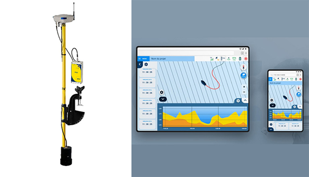
GEOD Bali is a compact hydrographic survey system all on the pole, including the necessary components for acquisition of bathymetric survey data.
BALI is a compact bathymetric survey system, fitted on a single tube and including all the sensors required to acquire bathymetric data:
- RTK (Real Time Kinematics) or DGPS SBAS GNSS receiver,
- single- (200KHz) and dual-frequency echosounder (200/30KHz),
- internal webserver,
- battery.
BALI process and store water depth measurements synchronised with an accurate georeferenced position. The internal GNSS receiver is compatible with GPS, Glonass, Galileo and Beidou, making measurement even in difficult areas possible. The RTK version helps making survey in areas with variable water heights easier (estuaries, rivers, etc.), in order to compensate water level differences between the start and the end of the readings.
The different RTK precision modes available are:
- RTK GSM for a centimeter accuracy with an NTRIP network (Orphéon, Teria…);
- RTK UHF for a centimeter accuracy with your own reference station;
- RTK L-Band for a centimeter accuracy with differential corrections by Trimble RTX satellite.
Thanks to the transducer with built-in temperature sensor, BALI adjusts the measured water height.
The BALI webserver offers a very simple browser interface, allowing the operator to follow the route from any interface with Wifi: phone, tablet, PC, etc.
BALI can also be coupled to bathymetrics software, such as QINSy Inshore or Hypack Max, providing additional features for project preparation, navigation, acquisition and publication of bathymetric maps.
For more details: Cadden’s products website. BALI is part of the GEOD® product range, designed and manufactured by Cadden.


